

You decide to visit a city or region you don’t know. But how to explore it? You may choose a travel guide and/or a map.
When deciding to choose a map for your specific purpose, what kind of map do you use?
Maps are a graphical or visual geographic inventory. But how do we want or like to use this inventory.
In the time of Computers, Internet, Smartphones and Tablets, printed maps got digital competitors: digital maps and geospatial applications with which you can use these geographical inventories everywhere we want.
I don’t think, printed maps will die. In the following, we will discuss printed and digital maps.
more about maps


Where do we meet and use maps?
Maps are a common graphical way to communicate facts about the (geographical) space. So we meet maps in many places and forms, e.g.:
- wall maps in schools
- city maps, street maps, hiking maps
- Situation and thematic maps in atlas, encyclopedias …
- maps in articles of newspapers and magazines
- meteo maps
- touristic flyers
- or nowadays also in search results and social media
- for art and decoration
- …
Many of us still are grown up with analog maps, but many of us are also regularly using digital tools to be informed.
In the digital world, we do not only meet digital copies of printed maps, which are static maps, more and more maps in the digital word also are interactive and/or dynamic.
When we ask the question “printed or digital maps?“, it is not only if analog or digital, but also static or dynamic.
Map Presentations
There exists various kinds of map representations. These representations are also related to their usage. As the title of this article says, the main categorisation is printed or digital.
Instead of printed, we may talk from analog maps. With printed maps we often assume a larger amount of copies, but it may also exist only one copy of a map, depending on its purpose, or maybe if the map is made manually with traditional drawing methods.
Another categorisation is static or dynamic. Printed maps are always static, digital maps may be static or dynamic; and dynamic has to be to be precised: dynamic maps may be just zoomable, or when zooming, they change content. More sophisticated dynamic maps may als individually change their content by usr control, there may be queries about the map content or you may want to get information (properties, attributes) of individual map objects. Or you may want to change the symbolisation of some map elements.
Printed Maps
Printed or analog maps have some external properties like the size and the material where the map is drawn or printed on. Other erxternal properties may be the layout of the map, if it has descriptional information like title, map legend, more metadata or other physical properies like if it is folded or plane.
To the internal properties belong the map extent (geographical area), the map scale, the map content and the map symbols.
Printed maps are designed for a specific map scale. The map scale is a regulator for the map content and the map details that the map remains readable.
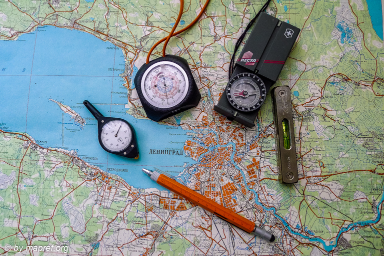
Printed Russian Map and Classical Cartometry Tools
Static Maps
One group of static maps are printed maps. Another group are the digital maps. Printed maps have a specific extent, digital static maps may have a seamless extent. But what are commons of static maps:
- specific map scale
- predefined content
- symbolised objects
- labels of objects
- in many cases coordinate reference system markers.
Digital Maps
Digital and interactive maps nowadays are a sophiticated method to present spatial data. Comparing to analog maps, you need a digital device and corresponding software for viewing them.
The static digital maps we alredy talked about above. The next level of digital maps are zoomable maps. Zooming means changing the map scale and with it the content, but for each zoom level, the map is static. Due to zooming and panning functions, it has a limited interaction.
More sophiticated digital maps are maps with intelligent interaction. This means, you can identify objects and getting information about them.
Sample of a Zoomable Map
last update: 25.03.2020
published: 21.11.2018
[to be continued]
more about maps

