Loading

MapRef.org - MapMaking & GeoSpatial Insides

  • CRS
  • Glossary
  • GeoLingua
  • Publications
MapRef.org – GeoSpatial And MapMaking Insides

MapRef.org – GeoSpatial And MapMaking Insides

MapMaking, GeoSpacials, Coordinates and more

  • Insides
    • Map Making
    • Map Projections
    • Coordinate Reference Systems
    • Spatial Data
    • Data Modelling
  • MapRef.org
    • GeoLingua
    • Glossary
    • Publications
    • MapRef on Facebook
  • Shop
    • Fan-Shop
    • Gadget-Shop
  • Maps
  • e-cards
  • Donate
  • About
    • About Dr. Stefan A. Voser
    • Contact
  • Log In
    • Lost Password
    • Reset Password

Homespatial data infrastructure

Posts in category: spatial data infrastructure

Datenlandschaft der Geodateninfrastruktur der Schweiz – Vision von 2002

Datenlandschaft der Geodateninfrastruktur der Schweiz – Vision von 2002

12/09/2020
by Dr. Stefan A. Voser with No Comment MapRef-Forumspatial dataspatial data infrastructure

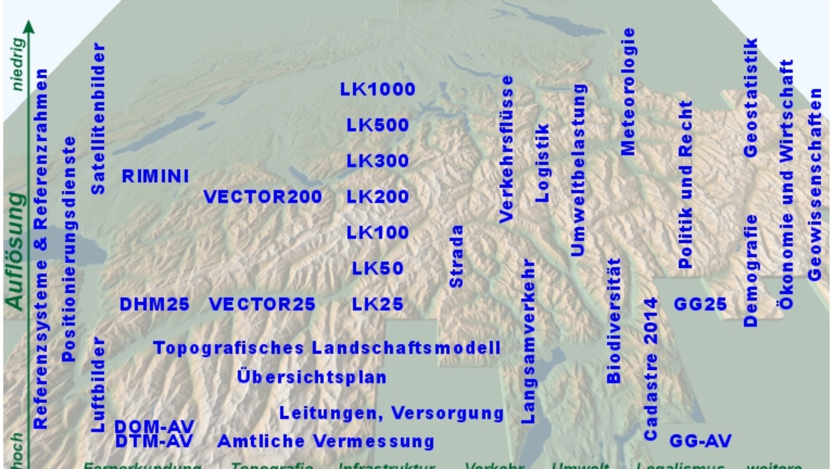
Spatial Data of the Spatial Data Infrastructure – Vision of 2002
Datenlandschaft der Geodateninfrastruktur der Schweiz – Vision von 2002
Dr. Stefan A. Voser
mapref.org

Read More
NSDI-GDI-Allgemein_wie_768

Geodateninfrastruktur – ein paar Grundsätze

13/05/2020
by Dr. Stefan A. Voser with No Comment spatial dataspatial data infrastructure

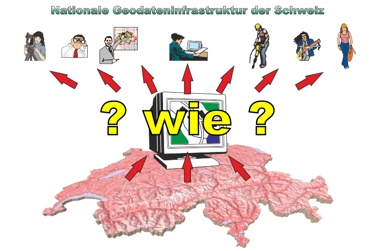
Spatial Data Infrastructure – some principles [in german]
Geodateninfrastruktur – ein paar Grundsätze
mapref.org – Dr. Stefan A. Voser

Read More

Follow Dr. Stefan A. Voser & MapRef.org

Follow Us on E-mailDr. Stefan A. Voser @ LinkedInMapRef on FacebookMapRef on InstagramFollow Us on mapref.orgFollow Us on Dr. Stefan A. Voser @ Xing

Recent Posts

  • goode interrupt land mollweide Map Projection Selection by Regional Use
  • World Gravitational Model 2008 Worldwide – Geoid EGM2008
  • worldwide Worldwide Coordinate Reference Systems
  • Swiss Geoid 2004 Switzerland – Geoid CHGeo2004
  • Countries in Europe National Coordinate Reference Systems in Europe

Topics

  • Coordinate Reference Systems
  • Basics of Spatials Data Data Modelling
  • Geometry of Maps & Spatial Data Map Making
  • goode interrupt land mollweide Map Projections
  • Printed Russian Map and Classical Cartometry Tools Spatial Data

Popular

MapMaking

Understanding Maps

265 views
Printed or Digital Maps

Printed or Digital Maps?

213 views
3d-Panorama with Symbols

Cartography and Geospatial Visualization

127 views
MapRef.org – GeoSpatial And MapMaking Insides
© 1996-2026 MapRef.org - GeoSpatial And MapMaking Insides. All rights reserved.
Shopping Basket
We use cookies to ensure that we give you the best experience on our website. If you continue to use this site we will assume that you are happy with it.